
 This week – your Grand Poobah is conducting snow survey for quality control.
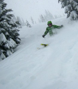
Ski: K2 Annex 98 Warm & dry: OR gear
The final storm, in this current week long series of storms, may be the “best in show”. The reason I am optimistic is the snow level lowers to 2000 ft , to improve quality with generous amounts of new snow – but not the heaviest snowfall of the series. However, it’s on top of all the snow, which has fallen – the powder icing on the cake. Stevens and the Summit may benefit from a convergence zone, for enhanced snowfall in those locations early in the day – but that zone may drift south to Crystal and White for additional snowfall, by lunchtime.
We’ve had six feet or more new snow for the Cascades in the last week. Amazingly, we went from a very lean snowpack to near normal in about a week. This was a huge snowfall dump, which improved depth and coverage.
While this has been a remarkable pattern, the snow was sometimes a tad dense at lower elevations. Thursday should be better with the colder temperatures and a 2000-2500ft ft snow level.
This is one of the best series (multi-storms in 7 days) of powder storms in recent memory. However the benchmark for the ultimate series is Mt Baker February 1999 (La Nina) – they had about a foot a day, everyday of the month. At the end of the season, Baker set the untouched world record 1140 inches in one season – greatly assisted by that epic Feb. Washington officially has the deepest measured seasonal snowfall on earth. Our expectations are high, but we often hit the mark.
Overnight snowfall will be 4-9″. Thursday will see snow off and on with 4-7″ new and a SL of 2000 – 2500 ft. Friday decreasing snow ( 1-3″ new) Great skiing, sun breaks.
The weekend will see a little new snow, mainly Sunday, but expect mostly dry with sunbreaks on Saturday. Expect wonderful skiing on groomers and untracked powder.
Ski safe – with a partner, always inbounds.
Grand Poobah
