 Powder Alert
Dec 22
Happy Holidays
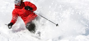
Finally, there is some good news from the weather dept. How about 1-2 ft of Cascade snow between late Tuesday and early Sunday?
We’ve got two good storms coming and only one minor, fleeting, snow level issue.
Here is how the snow story unfolds…
Late Tuesday, a weather system will move in with some brief high snow levels (5000-6000ft), so there will be some liquid snowflakes to begin the program. However, the pattern is progressive, with colder air lowering the SL to 2500 – 3000ft in short order. At that point the storm produces snow (3-9″), then concludes by late Wednesday.
There will be a break on Christmas and Friday. Check your favorite area for hours of operation. Then comes storm # 2. I like this one, as it has very little mild air with it and a low snow level ( 2000-3000ft), The storm will produce new Cascade snowfall, very late Friday to late Saturday for another 6 -12″. There is potential for decent snow falling in the lower elevations. The Summit should really benefit, with the low snow levels. I am considering a bona fide “powder alert” for Sunday, as the snow from Saturday wraps up early Sunday morning. Be aware of thin spots under the respectable new snow, as bases remain shallow in spots on lower slopes.
Last weekend weather review….
Right now several areas are partially open with limited terrain and hours of operation. The Methow Valley (including Loup Loup) have actually fared pretty well so far, not affected that much from the recent high snow levels. Mission Ridge has been cranking out the snow making and will see even greater improvement with this new snow ahead. These two storms should put Mt Baker in play, so watch for that. White Pass, Crystal, The Summit and Stevens have all been almost or partially open. I am optimistic the storms coming up will facilitate more widespread opening of ski area terrain.
Last weekend’s storms actually didn’t hurt the modest snowpack that much. Snow was falling for the first part of the storm – even at lower elevations. Later in the day, last Saturday, the rain on snow consolidated the snowpack, but didn’t wipe it out.
That is all behind us – now expect new snow ahead!
Poobah

